Windorah – Goondiwindi

Leaving Windorah was the start of our slow trip back towards Goondiwindi.  Quilpie was our next destination for a couple of days.  After seeing all the traffic in Windorah heading for Birdsville, we certainly copped a lot more on the way to Quilpie.   It is a single lane bitumen road to Quilpie and its a pity some people don’t know how to pass on these roads.  Lots of drivers get completely off the road and spray rocks every where.  It was a 250km trip to Quilpie and we must have passed over 150 caravans and campers heading towards Birdsville in that distance.

At the Quilpie CP

We booked into the Channel Country Tourist Park in Quilpie.  They had a deal for a three day stay so we took advantage of the offer.  They had no regular powered sites left and gave us one at the back on some grass.  It was probably one of the best sites in the park as we had no neighbours and grass.  The regular sites just had dirt and concrete slabs.  We weren’t complaining at all.

Quilpie has a few sites to see if you want to spend the time looking around.  They have an excellent small military museum that has some great displays.  Quilpie is also known as the “end of the line”.  Quilpie was proclaimed a town in 1917 due to the arrival of the rail from Charleville.  This was where the rail line finished and to this day is still known as the “end of the line”.  We did a sunset drive out to Baldy Top Lookout and had the obligatory wine while the sun set.  Considering how busy the town was with tourists we were the only ones out there which did surprise us.

Quilpie is also known as the “Jewel of the Outback”.  This is where they find the boulder opal.  You can buy lots of souvenirs around the town as well as find some at the fossicking area just out of town.  St Finbarr’s Church in the town has a altar covered in the opals.  It mustn’t be a really valuable type of opal though because when we arrived at the caravan park to book in there was a wheelbarrow full of rocks with the opal in it that you could just help yourself to.  We also did the Bulloo River Walk on the edge of town that was OK but could do with an upgrade to make it a bit more walker friendly.

St Finbarr’s opal altar in Quilpie
Quilpie
Quilpie
Quilpie artwork
Quilpie artwork
Along the Bulloo River Walk
At Baldy Top Lookout waiting for the sunset
Almost sunset
Sunset at Baldy Top Lookout

Charleville was next on our destination list.  We stayed a few kilometres out of town at the Charleville Bush Camp.  This is a no smoking/no pets caravan park.  It was nice to stay somewhere for a change and not have dogs toileting everywhere.  I even got offered a job there as a gardener when we pulled up to book in but all they offered was free accommodation and nothing else, so I very politely declined.

Charleville is quite a large town for the area and does offer good shopping and facilities.  You can do a tour of the airport that unfortunately we missed out on that tells quite a remarkable story of the Second World War.  During WW11 the USAAF had around 3500 personnel in Charleville and this is where they assembled their bombers for the Pacific War Campaign.  Charleville was selected because of is remote location and was too far for enemy planes to reach before running out of fuel on there return flight home.  They were also testing a new highly secret bomb siting instrument on the bombers that would provide more accurate bomb drops.

There is also the Charleville Bilby Centre to visit as well.  We had never seen bilby’s before so were looking forward to this.  They had about six bilby’s in their little nocturnal house to look at.  They have a good breeding program going and release them into the bush quite often.  Just a pity the light in the compound wasn’t a little bit easier to see them though.

Another interesting Charleville story is around 1902 when a well known meteorologist named Clement Wragge came to Charleville in the time of a severe drought in the hope to make it rain.  He used some “cannons” called Stiger Vortex Cannons that would shoot air up to clouds and hopefully make rain.  These were a European design that supposedly had been used successfully in Europe.  Needless to say the experiment wasn’t a success.  Clement Wragge was also the founder of the Meteorological Society of Australia and was also the first person in the world to give names to cyclones.

The day we arrived in Charleville the town had got together to try and break the record for the worlds longest damper.  They used to hold it before some nasty Europeans broke the record and made one about 111 metres long.  We got there not long after the damper had been cooked and they did set a new world record.  The new record is now 153.002 mtrs.  Mustn’t forget the all important 2mm at the end. Any way well done Charleville and we also got a piece of the damper to take home, cant beat that.

At the Charleville Bush Camp
Charleville
World record damper fire pit
Dampers cut up after the new world record was set of 153.002 mtr
Clement Wragge story
Clement Wragge and the Stiger Vortex Cannon story
The remaining Stiger Vortex Cannons
Charleville museum displays
Charleville Bilby Experience

Mitchell was our next one night stop.  This was just a small town that had a great butcher.  Recommend this place if you need some meat supplies when passing through.  From Mitchell it was onto Roma and the Roma Gun Club for one night.  As we had been through Roma previously on our other travels we didn’t really want to stay any longer than one night.  A trip to Woollies’ and a top up with fuel was the extent of our Roma visit.

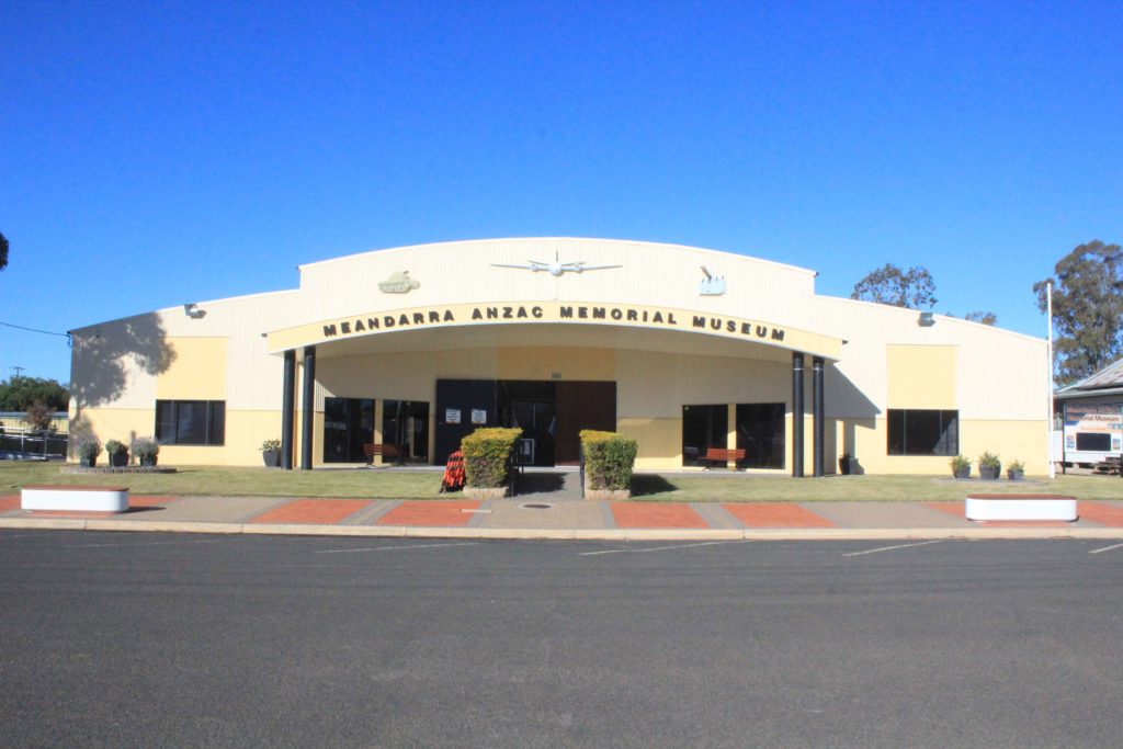
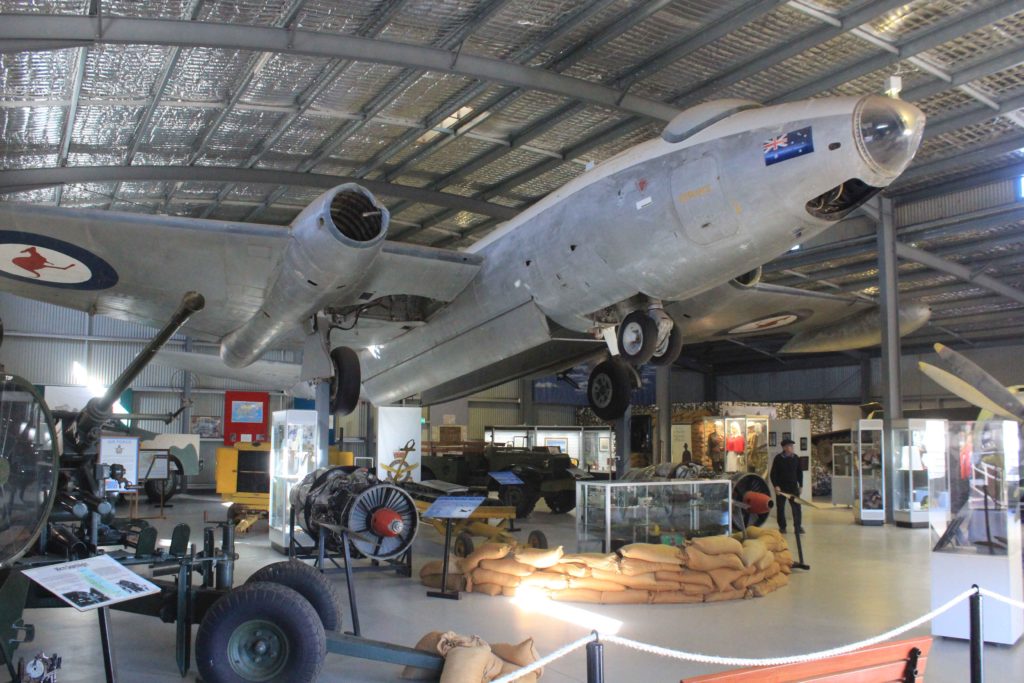
From Roma our next stop over was a very small place called Meandarra.  They have great little caravan park in Meandarra that is only $10 pn with power and water.  Why would you free camp at those prices.  We did a walk from the caravan park into the town centre which wasn’t very long at all.  In the main street we saw the Meandarra ANZAC Memorial Museum so decided to go in for a look.  What an excellent display they have.  The local community have really done an impressive job with the display and collection.

At the Meandarra CP
Meandarra ANZAC Memorial Museum
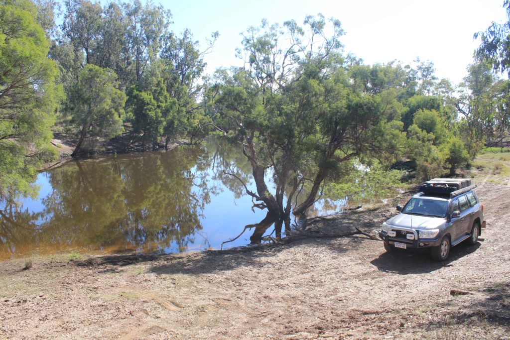
Brigalow Creek at Meandarra

Our next stop is back to Goondiwindi again.  We seem to be regular visitors to this town.  We are meeting up with Jade and the boys for a week of camping.  Jade wants to get away from the cold Canberra weather for a while.  I hope the weather is good enough as we think its pretty bloody cold here at the moment.  Should be good fun as we have a farm stay organised. 

Salvator Rosa NP – Windorah

After a great stay at Salvator Rosa NP and picking up our van from the station we left it at we just did a short drive along the gravel and stayed in a small clearing located in the Goodlife section of the Carnarvon Gorge NP.  Not sure if this was allowed but no one was around so we did it anyway.  We originally weren’t going to go to Tambo on this road but after talking with the good people at the station we left our caravan at, they told us the road was quite good and more scenic, which it was.

Next day it was a only a short 90km drive into Tambo.  Along the way we passed through one of the few dog proof fences that you do pass through in this area.

Dog proof fence on the road to Tambo

Tambo was another one of these small outback towns in Queensland that make quite an effort to make you stay in the town.  We booked into the Tambo CP for 2 nights and then went and saw the sites of the town.  Tambo is home to the Tambo Teddies that started in town in 1992 when wool prices crashed and the local community was challenged to come up with a new industry to help sustain the economy of the small town.  They are very nice teddies and have become quite famous around the world with even royalty having been given teddies as presents.  There is a Qantas crash site that you can visit just on the edge of town.  Back in March 1927 a bi-plane on its usual mail run dived into the ground killing the pilot and the two passengers on board.  Besides the sign explaining what occurred there isn’t much else here to see unfortunately.  Just near the site there is the Coolibah Walk that goes for just over 4km and traverses each side of the Barcoo River that the town sits beside.  Tambo also has a couple of nice old buildings in the main street that help add to the character of the place.

On our second night in Tambo we went to the Royal Carrangarra Hotel to watch Ben’s Chicken Races and have a meal.  The chicken races are a fund raising event for the RFDS and quite a hoot.  There are around 10 chickens that are auctioned off and then they race around a small track four times chasing a remote control car with feed on it.  Its very funny to watch as some of the chickens run, some in the opposite direction and some not at all.  The buyer of the winning chickens gets half of the total monies raised and the other half goes to the RFDS.  Great couple of hours and worth doing if your ever in Tambo.

Qantas crash site at Tambo
Sculpture representing the wool days of Tambo
Old Tambo Court House
Tambo Post Office
Tambo main street
At the Tambo Teddies store
The Barcoo River on the Coolibah Walk

Blackall was our next destination just over 100km up the road from Tambo.  We stayed at the Barcoo River Camping area in Blackall.  At only $8 pn it was quite good value but no power or water.  It was OK for a couple of nights but we wouldn’t stay much longer than that.

Blackall is quite a reasonable size town with quite good shopping if you need to stock up a bit.  One of the attractions we visited was the Woolscour just out of town.  This is Australia’s last remaining steam driven wool washing plant that is now just a fully operating museum.  When it closed back in the day they just walked away and left everything there.  A group of locals got together and restored parts of the plant and got it running again as a museum.  They have done an excellent job and its well worth a visit.  There is also a free flowing artesian bore at the Woolscour as well and the hot water coming out of it was used when the place was in full swing.

The Blackall Aquatic Centre was also worth going t for a swim as well.  The pool is constantly being fed by the hot artesian water and they have built this incorporating a 50 mtr swimming pool.  Another feature of the pool is that they have made both sides of the pool a walk in feature.  With the hot bubble spa as well they have done an excellent job of the facility.

The original Black Stump is also at Blackall as well.  In 1888 surveyors used this site to help fix the position of principal towns and enabled the mapping of Queensland on a more accurate basis.  As time passed any part of the country to the west of Blackall was considered to be “beyond the Black Stump”, and this is where the saying originated.

Camped at the Barcoo River Camping Area
One of the many impressive art works in Blackall
Blackall main street
Black Stump at Blackall
Blackall Aquatic Centre
Artesian bore at the Blackall Woolscour
Blackall Woolscour
Shearing stands at the Blackall Woolscour
Blackall Woolscour
Blackall Woolscour
Old sheep yards at the Blackall Woolscour – this timber is over 100years old

From Blackall we were heading to another National Park for a look.  Idalia National Park was our destination and this on a good gravel road only about 100km away from Blackall.  When we read up on this park it said it was suitable for caravans so we decided to try it out.  The campground was quite good but unusually it didn’t have any real designated camp sites, you just pretty much parked anywhere.  There were a few fire pits around so we camped near one of these in a pretty good spot.  There were 4 other vans camped out here when we arrived.  This did surprise us a bit as at the other parks we had visited in this area we were the only ones camping.

There were a couple of drives you could do around the park that had a couple of short walks at the end of them though nothing to long.   The Bulloo River also passes through the park and is mostly dry.  Emmet Pocket Lookout does offer some good views over the escarpments.  There were also some quite unique stockyards made up from a time gone by that they intertwined mulga branches through wire to make fences.  These were then strung between trees and used to hold stock during musters before it became a National Park.

Camping out at Idalia NP
Some of the unique stockyards used when Idalia was a working station
Wave Rock at Idalia NP
Walking at Idalia NP
It was quite green at Idalia in places
Billabong at Idalia NP
Emmet Pocket Lookout
Emmet Pocket
Escarpment views at Idalia NP
Old fencing in ruins in Idalia NP
Someone was keeping an eye on us
Idalia NP gorge walk

Isisford was our next place of rest on our little trip through Central West Queensland Outback.  We stayed at the Barcoo Weir Campgrounds on the edge of town.  This was $3 pn or $15 pw if you wanted to stay longer.  When we arrived we were a bit taken aback at how busy it was.  There were lots of caravaners staying here.  After speaking to some of them they were staying here for up to three months and came here every year.  We asked one chap what he did to fill in his time and his reply was collecting firewood, fishing and relaxing.  There is the Oma Waterhole a few kilometres out of town that you can stay at for the same price.  We did a drive out here for a look as well and it was also very busy and it looked like some were set up for a long stay.  Longreach is only about 100 kilometres away and lots would drive up there every so often for day trips.

They have made some of the older shops in the main street static museum displays of how they would have been around 50 years ago, and these were really interesting.  Some of the items on display brought back many memories.  We did a meal at the local hotel while in Isisford and thoroughly enjoyed it as well.  There was also the annual fishing competition coming in a couple of weeks and they say the town really swells at the seams when this is on.  The main catch in the Barcoo River is Yellowbelly and attracts lots of enthusiasts.  On the edge of town there is a large tin statue of a Yellowbelly on display that welcomes you.

Old shops in Isisford
Isisford old hotel in main street
Barcoo River at Isisford
Barcoo River weir near our campground
A big Yellowbelly welcome to Isisford

Leaving Isisford we had a choice of a couple of directions we could take to our next stop which was Stonehenge.  One route was to follow some more bitumen or the other was some gravel that saved about 80 kilometres.  We decided on the gravel and glad we made the choice.  The road was excellent and no traffic.  Only passed one car in the 100 km of gravel.  Most of the country side was good to look at and with no other vehicles the drive was very relaxing.  There were also some pretty impressive displays of Mulla Mulla to drive past as well.

Morning tea break on the road from Isisford to Stonehenge
Mulla Mulla was everywhere on the trip to Stonehenge

Stonehenge was only a one night stop in there very well presented caravan park.  This was only $16 pn with power and water.  Great deal.  There is a very different pub in Stonehenge, doesn’t really look like one at all.  This was a good excuse for me to have a night off from cooking so to the pub for a meal it was. 

Nice display at Stonehenge

Windorah was the next place on our Queensland trip west.  This was as far west as we were heading before turning back on some different roads.  We didn’t realise that the Big Bash was coming up in Birdsville, because Windorah was very busy.  They have a really good caravan park in Windorah that is only $16 pn as well.  We stayed for two nights as Kaye again was falling behind in washing and I desperately needed clean clothes.  Both nights we were here the park got full with vans and campers heading towards Birdsville.  We were glad we weren’t heading there as well as they were expecting over 12,000 people and around 3500 vans and campers. 

They have a pretty impressive solar farm at Windorah that didn’t seem to be operating when we looked at it.  No one could really tell us if it was going or not.  We did the nature drive that was a 12km drive along a dirt track with signs pointing out different tree species.  It was OK though not overly interesting.  Just out of town there is the Cooper’s Creek Camping Area that looked like it was OK.  For a creek there was a lot of water in it, quite impressive.

Windorah Nature Drive
Cooper’s Creek
Campers at Cooper’s Creek
Windorah’s impressive solar farm
Old court house at Windorah that is now a “private residence”
Windorah main street

Well Windorah was as far west as we were going this trip.  Our next turn is left at Windorah then heading back in an easterly direction.  We have seen some great sites so far and hopefully the rest of this little venture will be just as good.

Bundaberg – Salvator Rosa NP

After a pretty relaxing stay in Bundaberg it was in a westward direction and inland for a few weeks of travelling.  Our first place to stop was Eidsvold.  We decided to stay just out of Eidsvold at the Tolderodden Regional Park.  This was only a few kilometres out of town and was free.  What more could you want.  Another bonus was that we were the only ones camped here and there was also fire wood around.

Our camp at Eidsvold – had it all to ourselves

There is a bit to see around the Eidsvold area and we had no trouble filling in a couple of days looking around.  Archer Homestead was worth a visit.  This is the original homestead of the Archer family who were brothers from Norway and were some of the original pioneers of the district over 100 years ago.  The RM Williams Australian Bush Learning Centre is also worth a look.  The centre provides stories of the people around the district and their contributions to the past.  RM Williams also settled at Rockybar, a cattle property just west of Eidsvold in his later years. 

At the RM Williams Australian Bush Learning Centre

Theodore was our next destination.  They have a free camp at Theodore and we checked that out to stay at.  It was very crowded and quite shady so we moved on.   We stayed at the Theodore Rec Reserve and Showground which we felt was better as you had more room and power and water for only $20..  This is where we started to see lots of caravaners doing the inland trek.  We weren’t sure how busy it would get with grey nomads and Theodore was the start of the crowds.

Theodore is a very neat town and had a bit of a mining town feel for both of us with the way it was laid out and maintained.  The local hotel is run by the community and all profits go back into the town.  Theodore also had a bit to see around the area and two days was filled in quite easily.  We did a drive out to Isla Gorge National Park with the intention of doing some walks.  When we arrived it was really just a lookout with only a couple of short paths.  We were a bit disappointed with this but you cant have everything I suppose.

Isla Gorge National Park
Weir near Theodore
Theodore water tower and park
Theodore main street
Old church in Theodore

From Theodore our next destination was Rolleston.  On our drive to Rolleston we stopped at Cracow for a morning tea stop near an impressively painted water silo.  Its good to see when some places make an effort to make ugly eyesores a bit more pleasing to the eye.

The impressive water tower at Cracow

Rolleston was a very small town and was only a washing stopover for us.  Kaye had fallen behind with the laundry and we couldn’t fit anymore dirty clothes into the cupboard.  With all the grey nomads on the road the community had opened a coffee van in the park which was very popular with the passing traffic and those of us who had decided to stay for the night.  We did do a drive out to a billabong close by and had a nice picnic lunch with all the flies.  They were starting to get very friendly by now as we were heading further west.

Another thing we had noticed as we were travelling was the amount of butterflies everywhere.  The bush out here certainly attracts them in the winter months and they are quite prolific. 

Our billabong lunch stop at Rolleston

Springsure was our next stop for a few days.  This was a bit bigger town and had some good shops for restocking.  The Showgrounds were our home for a couple of days and worth the stay.  While in Springsure we did a drive out to Old Rainworth Fort that has quite an interesting story attached to it.   In October 1861, 19 people of the party from Victorian settler Horatio Spencer were massacred by aboriginals not far from Rainworth Station as it was known then.  During the attack Edward Kenny managed to escape on a saddled horse and rode to Rainworth and broke the news of the attack.  No reasons were ever discovered for the attack and in the reprisal attacks no accurate number of aboriginals killed was ever known.  It was because of this incident that Rainworth Station acquired its “Fort” title.

Also very close to Springsure is the Minerva Hills National Park only a few kilometres out of town.  Some of the views from the top of the surrounding area are very impressive and also over the town of Springsure itself.  Pity about the road into the park though, it was very rough.

Old Rainworth Fort
Old Rainworth Fort
Old Rainworth Fort
The old Cairdbeign School
Minerva Hills NP – Skyline Lookout
Minerva Hills NP – Freds Gorge Lookout
Minerva Hills NP – Springsure Lookout

From Springsure we were going on gravel for a while and heading ultimately to Salvator Rosa NP.  Our road was the Dawson Development Road and we had heard mixed reports on its condition and how bad it could get as well.  We have found that most times you are best off just going on the roads as we have found most peoples opinions of a bad  gravel road are very different to ours.  We were heading for a rest area only around 115km up the road for the night.  Besides around 10km of reasonably bad corrugations the road was very good and our rest stop for the night, though close to the road was good and we did have a nice fire for the night.  Plenty of firewood out here, and flies of course.

Morning tea stop on the Dawson Development Road
Our nights stopover on the Dawson Development Road

On the web site for the National Park we were going to they said that the road in wasn’t suitable for taking caravans on, so we had phoned ahead to a station not far from Salvator Rosa and asked if we could leave our caravan with them for a couple of days.  They very nicely obliged so the next day was a short drive to drop the van off then onto Salvator Rosa NP.

Salvator Rosa is a section of the Carnarvon National Park.  The campground at Salvator Rosa is called the Nogoa River Campground and we had it all to ourselves. We weren’t expecting to see many people out this way, but were surprised that we were the only ones here.

There are a few tings to see at Salvator Rosa with the crystal clear spring fed creeks being a highlight.  Though there were no overly long walks the treks up to Homoranthus Hill and around Spyglass Peak did offer some impressive views of the area.  Major Thomas Mitchell and his exploration party camped near this area in 1864 and used the springs to allow his men and bullock teams to recover after exploring the country to the north and east.  It was Mitchell who named the area Salvator Rosa as it reminded him of the paintings by an Italian Baroque painter of the same name in the 1600s.

Our camp at Salvator Rosa – Nogoa river Camping Area
Salvator Rosa NP – Spyglass Peak
Salvator Rosa NP
Salvator Rosa NP
Salvator Rosa NP
Salvator Rosa NP – Belinda Springs
Salvator Rosa NP – Louisa Creek Junction
Salvator Rosa NP – China Wall Rock
Salvator Rosa NP – Grass trees regrowing after fire
Salvator Rosa NP – Spyglass Peak

We did enjoy our visit to Salvator Rosa NP.  Its not very big but it did have some nice places to see and the campground was pretty good as well.  As it happened we felt we could have easily bought the caravan in with us but we weren’t to know and anyhow we had a good time in the rooftop tent.  Now its just a short drive back to the van and then continue on the gravel towards Tambo.  Hopefully the gravel roads stay as good as they have been so far.